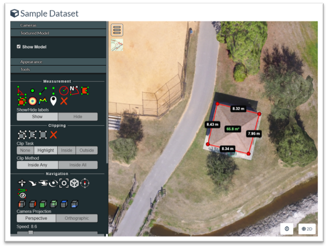
Twomile uses the science of photogrammetry and structure-from-motion (SfM) to convert aerial images into orthomosaic maps, digital terrain models (DEM), digital surface models (DSM), and more. Outputs are geo-rectified and suitable for use in GIS and CAD systems.
We also offer OpenDroneMap workshops and training.