“ The most neglected element in coastal risk management is regular monitoring to detect changes that may increase the likelihood of loss.“
University of Wisconsin Sea Grant Institute and the U.S. Army Corps of Engineers, Living on the Coast: Protecting Investments in Shore Property on the Great Lakes
We can help protect your investment. Regular shoreline inspection by drone is inexpensive, easy, and safe.

How does it work?
Initial Inspection
Our team will perform a full inspection of your site as described in the Shoreline Inspection page. You will receive a report that highlights any observed problem areas and describes the plan for ongoing monitoring, along with high-resolution photographs and video of the site and shoreline protection structures. This initial inspection provides a baseline for monitoring changes.
Ongoing Monitoring
Our team visits periodically to perform a new inspection of the shoreline and any shoreline protection measures. We will work with you to arrange access to the site. Following each visit, we provide a report of the shoreline condition, along with high-resolution photographs and other assets as specified in your monitoring plan.
Problem Alerts
At each inspection, we check for signs of recent changes in your shoreline, bluff, or protection structures. After the inspection, we perform additional analysis to compare the current shoreline state with prior inspections. If we detect any urgent issues we will call to let you know immediately. The overall status of your shoreline will be documented in the inspection report, along with highlights of any issues.

What do you get?
Our monitoring plans are based on Basic inspections, or Advanced inspections. Basic inspections are the simplest and least expensive option. Advanced inspections provide additional capabilities for monitoring the shoreline and precisely quantifying changes over time. Reports, photos, and video are provided online or on DVD, depending on your preference.
Basic Inspection
Basic inspections are the simplest inspections. At each inspection, we collect high-resolution photographs of the site and perform our analysis using current and prior photographs. We deliver a brief inspection report describing the condition of the shoreline and any shoreline protections, and highlighting any visible changes since the previous inspection. We deliver the report, along with 15-20 high resolution photographs following each inspection.
Advanced Inspection
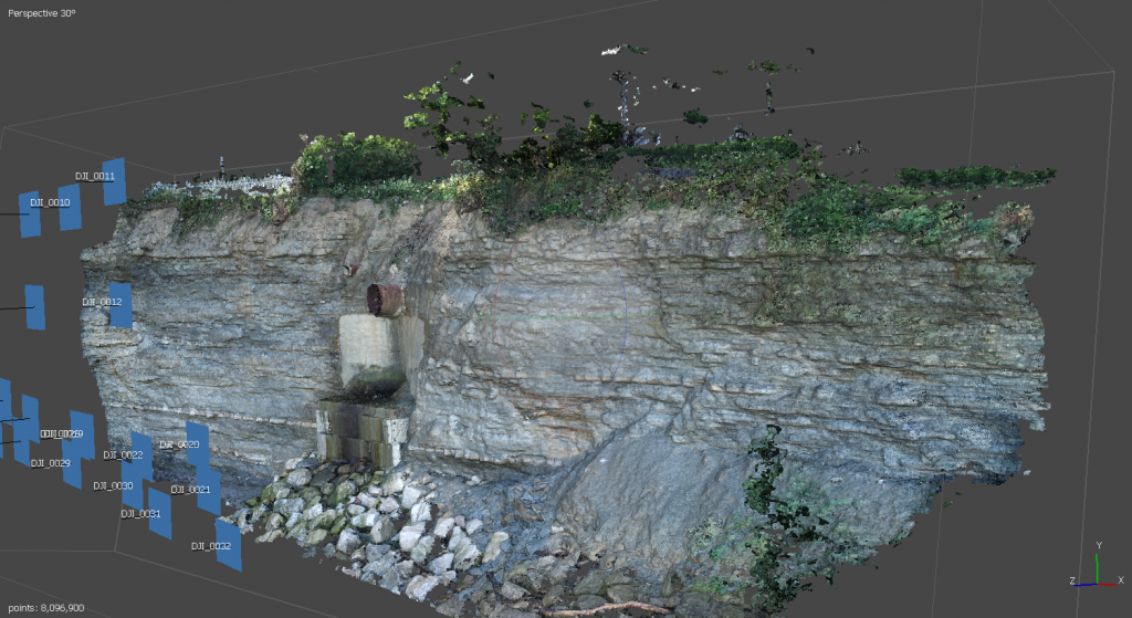
Advanced inspections provide additional capabilities for monitoring the shoreline and precisely quantifying changes over time. At each inspection we capture high resolution photographs as well as a video of the site. The photographs are used to create a new 3D model for each inspection. The model is then compared to previous models, to detect and quantify changes over time. Our analysis is based on the model comparison, and supported by a review of current and prior photographs. The Advanced Inspection report describes the condition of the shoreline and any shoreline protections, highlights notable changes, and provides an in-depth quantitative analysis of the changes. We deliver the report, 15-20 high resolution photographs, and site video.
Limitations
Drone inspection covers the shoreline, bluff, and any shoreline protection structures which are visible above the water line. This method cannot detect or monitor changes below ground, or below the water line. We can refer you to the appropriate engineering and geotechnical professionals for consulting on those matters, as needed.

How much does it cost?
Basic Plan $500/yr
Basic Inspection 2x/year
Advanced Plan $1250/yr
Advanced Inspection 3x/year
Premium Plan $2499/yr
Advanced Inspection 4x/year
Advanced Inspection following major storms

Did you know?
The University of Wisconsin Sea Grant Institute and the US Army Corps of Engineers recommend shoreline monitoring at least once per year, and after major storms.
Contact us today, for a free consultation.